
Preparation of engineering-geological reports and conclusions
Engineering-geological surveys and laboratory soil testing.
An engineering geological report is the definitive scientific and technical document of preliminary geotechnical investigations, synthesizing the complete results of exploratory drilling, in-situ soil testing, accredited laboratory assays, and geophysical site surveys.
Preparation of technical reports and conclusions based on the results of engineering-geological surveys in accordance with regulatory requirements.
In the capital and across all regions of Uzbekistan, the licensed engineering center GEO PRO delivers an authoritative engineering geological report Tashkent in strict compliance with ShNK and KMK urban planning standards. A comprehensive engineering geological report eliminates foundation design errors and protects developers from unanticipated structural settlement.
Professional preparation of engineering geological conclusions Uzbekistan provides structural designers with verifiable physical and mechanical soil properties, forecasts ground behavior under structural loading, and justifies the selection of cost-effective foundation systems.
High-quality desk study processing of geotechnical data guarantees immediate approval during the State Urban Planning Expertise review without delays or revisions.
Regulatory Standards: Engineering Geological Report Structure ShNK
Pursuant to the provisions of the Urban Planning Code of the Republic of Uzbekistan, every final engineering geological report must adhere to an officially standardized structure.
The standard engineering geological report structure ShNK incorporates the following mandatory technical sections and graphic annexes:
- Explanatory memorandum outlining climatic, geomorphological, tectonic, and hydrogeological site conditions;
- Consolidated statistical summary tables detailing the physical-mechanical parameters of identified Engineering Geological Units (EGUs);
- Certified laboratory test sheets (oedometer consolidation tests, direct shear, triaxial compression, and particle size distribution);
- Groundwater chemical analysis certificates evaluating corrosion aggressiveness toward foundation concrete and structural steel;
- Drilling borehole lithological logs, longitudinal geological cross-sections, and stratigraphic fence diagrams;
- Site layout maps documenting the exact coordinates of exploratory boreholes, test pits, and cone penetration test (CPT) soundings;
- Seismic zoning parameters, baseline seismic intensity, and soil categories categorized by seismic properties.
A properly compiled engineering geological report provides engineers with an exact three-dimensional model of the subsurface ground conditions.
Desk Study Processing: Technical Report on Engineering Geological Surveys
The engineering analysis department at GEO PRO conducts rigorous mathematical and statistical data processing using specialized geotechnical software.
A comprehensive technical report on engineering geological surveys is developed with detailed evaluation for each soil stratum:
- Calculation of standard and design shear strength parameters (internal friction angle, cohesion);
- Evaluation of soil deformation moduli, initial void ratios, and coefficient of volume compressibility;
- Quantitative assessment of loess soil collapsibility, swelling potential, and piping suffosion vulnerability;
- Hydrogeological regime analysis with long-term predictive modeling of peak seasonal groundwater table rises.
Every engineering geological report provides an organized geotechnical ground model optimized for direct digital integration into finite element structural design software (PLAXIS, MIDAS, ETABS, SAP2000).
Foundation Optimization: Geological Conclusion for Construction Tashkent
For building reconstruction, vertical extensions, structural reinforcement, or low-rise private developments, express technical assessments are prepared.
An official geological conclusion for construction Tashkent delivers a concentrated summary of critical ground characteristics to guide rapid structural decision-making.
Our specialists formulate practical engineering guidelines regarding the depth of foundation footings, engineered soil cushion specifications, required waterproofing barriers, and pit dewatering measures.
Investing in an accurate engineering geological report prevents over-engineering and saves significant capital expenditures across foundation substructure works.
Legal Assurance: State Expertise Approval for Geological Reports
The definitive benchmark of geotechnical survey quality is obtaining an unconditional positive evaluation from regulatory authorities.
We provide full technical support to guarantee State Expertise approval for geological reports:
- Comprehensive engineering accompaniment throughout all stages of the State Construction Expertise review;
- Rapid preparation of justified technical responses to official expert inquiries within 24 hours;
- Official corporate licensing and mandatory registration of survey documentation within the unified state information system;
- Full legal, technical, and professional liability for the absolute accuracy of delivered geological datasets.
The completed engineering geological report delivered to the client satisfies all regulatory mandates of the Republic of Uzbekistan.
Cost Estimation: Engineering Geological Report Cost Tashkent
The total engineering geological report cost Tashkent is determined by the technical terms of reference, structural consequence level, and the physical scope of completed field investigations.
Pricing variables include drilling depth, borehole quantity, plate load testing requirements, and supplementary seismic microzonation calculations.
GEO PRO provides fixed, transparent commercial proposals without hidden costs, supported by milestone-based payment schedules.
Order Engineering Geological Report in Tashkent with GEO PRO
GEO PRO operates an accredited soil testing laboratory, a fleet of specialized drilling rigs, and a team of senior engineering geologists with over 15 years of industry experience.
A rigorously prepared engineering geological report avoids over-conservative safety factors and reduces total foundation construction costs by 20% to 30%.
To calculate your project estimate or order engineering geological report in Tashkent, submit an online request — our engineers will provide a formal commercial proposal within 1 business day.
Need this service? Leave a request — we’ll estimate the cost for your site. Request an estimate or call: +998 97 744-55-11.
Why choose us
Licenses and permits
We work officially: a laboratory and permits for engineering surveys.
Modern equipment
Modern total stations, GNSS receivers and drilling rigs.
Experienced engineers
Surveyors, geologists and ecologists with specialized education and on-site experience.
Official report
A technical report accepted by expert review bodies and design organizations.
How we work
Request and brief
We clarify the task, site and objectives, and agree on the brief and cost.
Field work
We go on-site: measurements, survey, drilling and sampling to standards.
Processing
Office data processing, calculations and analysis in specialized software.
Report
We prepare and deliver an official technical report with results and recommendations.
Our work: geology
Projects completed by GEO PRO in this field — total 17.
Pile testing (Pile Drive & Pull-Out), Samarkand 2 Solar 500 MW
Drilling works (2000 m), Fergana region
Geotechnical surveys, LNG peak-shaving facility (Syrdarya, Tashkent, Turakurgan)
Steel pile test (DVT), photovoltaic plant (Kashkadarya)
Topographic-geodetic and engineering-geological surveys, Andijan PV plant 400 MW
Geotechnical and geophysical works, «Bash and Jankeldy» (Bukhara region)
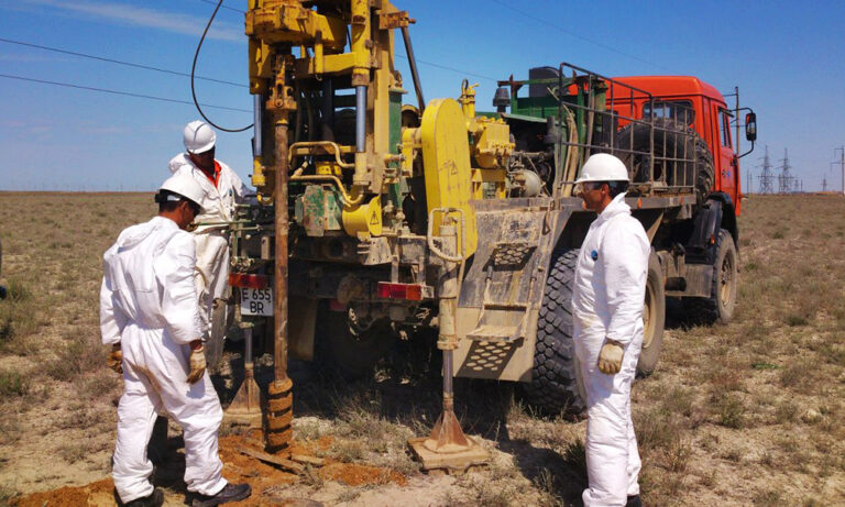
Topographic-geodetic and engineering-geological surveys, 500 MW WPP (Samarkand)
Engineering-geological survey of a power line (51 km), 500 MW solar plant (Sherabad)
Geotechnical studies, Nukus WPP (Karakalpakstan)
Cross-hole wave velocity measurements, 500 MW WPP (Bash, Zangeldy)
Engineering-geological surveys, 500 MW solar plant (Sherabad)
Engineering-geological surveys, combined power plant 1500–1700 MW (Uchkizil, Termez)
Geological exploration, «Dukhana» copper ore (Uzun district, Surkhandarya)
Engineering-geological surveys along a water-main route (65 km), Charvak — «New Tashkent»
Engineering-geological surveys (535 m drilling): Webster University and a school, «New Tashkent»
Engineering-geological surveys (635 m drilling): National Art Museum of Uzbekistan
Engineering-geological surveys (12 boreholes, 40 m each), «New Tashkent»
Thank you! Your request has been received
We will estimate the cost for your site and contact you shortly.