
Geophysical surveys
Engineering-geological surveys and laboratory soil testing.
Geophysical surveys represent a high-precision, non-destructive methodology within preliminary geotechnical investigations, enabling in-depth evaluation of subsurface stratigraphy, spatial soil heterogeneity, and physical-mechanical rock mass parameters without extensive excavation.
Geophysical methods for investigating the structure and physical properties of the soil mass at the survey site.
In Tashkent and throughout Uzbekistan, the licensed engineering center GEO PRO provides certified geophysical surveys Tashkent in strict compliance with KMK and ShNK building codes. Comprehensive geophysical surveys significantly optimize exploratory borehole grids and prevent the omission of concealed subsurface geological anomalies.
Executing professional engineering geophysical investigations for construction provides structural engineers with reliable computational parameters required to design secure foundations for high-rise towers, industrial plants, and transportation bridges.
Deploying advanced geophysical technologies enables project teams to delineate tectonic fault lines, identify karst cavities, map decompacted zones, and track water-saturated ground horizons.
Seismic Hazard Assessment: Seismic Microzonation SMR Uzbekistan
Under the provisions of the Urban Planning Code of the Republic of Uzbekistan, dynamic seismic calculations are mandatory for high-consequence structures.
We conduct standardized seismic microzonation SMR Uzbekistan to refine baseline site seismicity while accounting for the resonant properties and local stratigraphy of the ground.
During field operations, our geophysicists determine seismic intensity increments on the MSK-64 scale, construct ground response spectra, and generate synthetic acceleration time-histories for dynamic structural modeling.
Performing accurate SMR studies optimizes capital expenditures on structural earthquake-proofing while guaranteeing structural resilience against severe seismic events.
Geoelectrical Profiling: Electrical Resistivity Tomography ERT and VES Tashkent
Subsurface geoelectric profiling is carried out by specialists at GEO PRO using modern multi-electrode digital resistivity systems.
High-resolution electrical resistivity tomography ERT and VES Tashkent provides continuous 2D and 3D resistivity cross-sections across the building site:
- Mapping lithological boundary interfaces and bedrock topography beneath loose sedimentary overburden;
- Locating groundwater tables and identifying localized saturation zones;
- Delineating underground karst sinkholes, piping voids, and anthropogenic decompacted zones;
- Pinpointing tectonic displacement planes, structural fractures, and active landslide slip surfaces.
Resistivity tomography allows our team to trace strata continuity between boreholes without requiring costly supplementary drilling operations.
Seismoacoustics: Seismic Refraction Survey and Shear Wave Velocity
To determine dynamic elastic moduli of foundation soils, our engineers deploy shallow seismic refraction and MASW surface wave techniques.
We perform specialized seismic refraction survey and shear wave velocity logging to measure compressional (Vp) and shear (Vs) wave velocities:
- Calculation of dynamic shear modulus, Young’s modulus, and Poisson’s ratio;
- Assessment of weathering degree and fracture density in rock and semi-rock formations;
- Layer-by-layer evaluation of the average shear wave velocity within the upper 30-meter profile (Vs30);
- Quality control and compaction verification for backfilled soils and engineered soil cushions.
The derived velocity profiles serve as vital empirical input for modeling soil behavior under heavy dynamic, traffic, and vibrational loads.
Non-Destructive Testing: Ground Penetrating Radar GPR Utility Detection
For high-resolution scanning of near-surface strata, high-frequency electromagnetic radar pulses are deployed.
Standardized ground penetrating radar GPR utility detection enables centimeter-level localization of subterranean infrastructure and structural anomalies:
- Locating buried pipelines, high-voltage utility cables, concrete conduits, and municipal networks;
- Detecting washouts, sub-slab voids, and subsidence pockets beneath highways and industrial floors;
- Inspecting operational foundation elements and verifying pavement layer thicknesses;
- Evaluating structural continuity and concrete homogeneity across pile caps and monolithic slabs.
Well Logging: Borehole Geophysical Logging Services Uzbekistan
To correlate stratigraphy across multiple drillholes and refine hydrogeological parameters, in-situ downhole measurements are conducted.
We deliver certified borehole geophysical logging services Uzbekistan, including natural gamma logging, electrical resistivity logging, caliper logging, and flowmeter testing.
Downhole geophysical surveys accurately pinpoint water-bearing intervals, quantify formation porosity, and verify the physical integrity of borehole casings.
Pricing Breakdown: Geophysical Survey Cost per Site Tashkent
The consolidated geophysical survey cost per site Tashkent depends on the overall survey footprint, required exploration depth, and the selected combination of geophysical methods.
Our detailed estimate accounts for profile grid density, terrain complexity, and the computational scope of seismic microzonation modeling.
GEO PRO provides transparent quotations that encompass field data acquisition, digital signal processing, and comprehensive technical reporting.
Order Geophysical Surveys in Uzbekistan with GEO PRO
Our company maintains an advanced instrumentation fleet (24-channel digital seismographs, multi-electrode resistivity meters, multi-frequency GPR antennas) and a technical team with over 15 years of industry experience.
Every engineering report prepared by GEO PRO complies with state regulatory standards and guarantees seamless approval by the State Construction Expertise.
To request a cost calculation or order geophysical surveys in Uzbekistan for your project, contact our engineering department today — a detailed proposal will be prepared within 1 business day.
Need this service? Leave a request — we’ll estimate the cost for your site. Request an estimate or call: +998 97 744-55-11.
Why choose us
Licenses and permits
We work officially: a laboratory and permits for engineering surveys.
Modern equipment
Modern total stations, GNSS receivers and drilling rigs.
Experienced engineers
Surveyors, geologists and ecologists with specialized education and on-site experience.
Official report
A technical report accepted by expert review bodies and design organizations.
How we work
Request and brief
We clarify the task, site and objectives, and agree on the brief and cost.
Field work
We go on-site: measurements, survey, drilling and sampling to standards.
Processing
Office data processing, calculations and analysis in specialized software.
Report
We prepare and deliver an official technical report with results and recommendations.
Our work: geology
Projects completed by GEO PRO in this field — total 17.
Pile testing (Pile Drive & Pull-Out), Samarkand 2 Solar 500 MW
Drilling works (2000 m), Fergana region
Geotechnical surveys, LNG peak-shaving facility (Syrdarya, Tashkent, Turakurgan)
Steel pile test (DVT), photovoltaic plant (Kashkadarya)
Topographic-geodetic and engineering-geological surveys, Andijan PV plant 400 MW
Geotechnical and geophysical works, «Bash and Jankeldy» (Bukhara region)
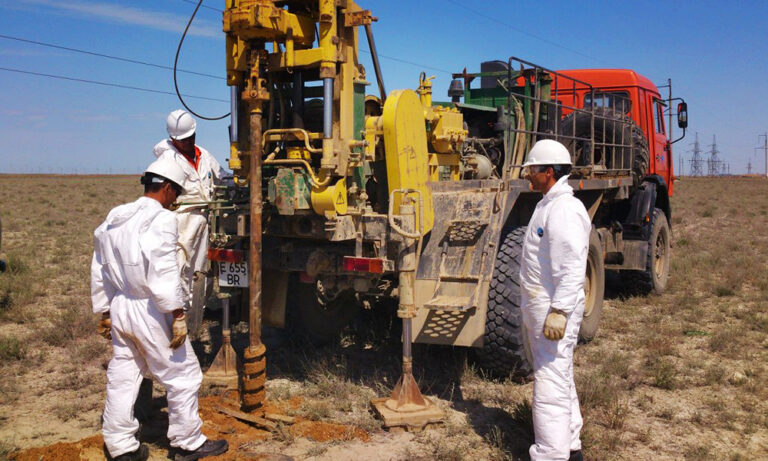
Topographic-geodetic and engineering-geological surveys, 500 MW WPP (Samarkand)
Engineering-geological survey of a power line (51 km), 500 MW solar plant (Sherabad)
Geotechnical studies, Nukus WPP (Karakalpakstan)
Cross-hole wave velocity measurements, 500 MW WPP (Bash, Zangeldy)
Engineering-geological surveys, 500 MW solar plant (Sherabad)
Engineering-geological surveys, combined power plant 1500–1700 MW (Uchkizil, Termez)
Geological exploration, «Dukhana» copper ore (Uzun district, Surkhandarya)
Engineering-geological surveys along a water-main route (65 km), Charvak — «New Tashkent»
Engineering-geological surveys (535 m drilling): Webster University and a school, «New Tashkent»
Engineering-geological surveys (635 m drilling): National Art Museum of Uzbekistan
Engineering-geological surveys (12 boreholes, 40 m each), «New Tashkent»
Thank you! Your request has been received
We will estimate the cost for your site and contact you shortly.