
Assessment of hazardous geological processes (landslides, karst, subsidence, mudflows) and recommendations for their prevention
Engineering-geological surveys and laboratory soil testing.
Hazardous geological processes encompass a spectrum of natural and anthropogenic phenomena capable of destabilizing ground massifs, causing severe damage to structural foundations, and generating substantial financial losses for capital construction projects.
Assessment of hazardous geological processes — landslides, karst, subsidence, mudflows — and development of recommendations for engineering protection.
In the capital and regional development zones, the accredited engineering center GEO PRO delivers certified hazardous geological processes assessment Tashkent in rigorous accordance with KMK and ShNK state regulations. Managing multifaceted hazardous geological processes requires ongoing geotechnical monitoring and high-precision computational modeling.
A proactively designed engineering protection against hazardous geological processes enables structural engineers to integrate reliable anti-landslide, anti-karst, and anti-subsidence engineering systems during initial architectural planning.
High-precision site surveys eliminate abrupt structural deformations, protect deep excavation walls, and secure the long-term operational integrity of commercial and industrial infrastructure.
Slope Stability: Landslide Hazard Assessment and Slope Stability Analysis
Across foothill zones and sloped terrain, compliance with the Urban Planning Code of the Republic of Uzbekistan mandates comprehensive terrain stability evaluations.
When potential slope instabilities threaten building plots, our structural geologists conduct a thorough landslide hazard assessment and slope stability analysis:
- Calculation of global factor of safety (FoS) across natural slopes and engineered cuts using specialized 2D/3D numerical software;
- Identification of critical circular-cylindrical, translational, and wedge slip surfaces within soil strata;
- Structural design of anchored retaining walls, contiguous bored pile screens, and passive soil nail grids;
- Numerical deformation modeling of deep urban excavation pits adjacent to sensitive historical or commercial buildings.
Proactively identified hazardous geological processes allow engineers to construct tailored retaining structures before construction begins.
Collapsible Strata: Loess Soil Collapse Investigation Uzbekistan
A substantial portion of national building terrain is comprised of thick macroporous loessial loams that undergo structural collapse upon moisture saturation.
Geotechnical engineers at GEO PRO perform standardized loess soil collapse investigation Uzbekistan across field and laboratory testing stages:
- Determination of foundation soil condition category (Type I or Type II collapsibility);
- Measurement of initial collapse pressure thresholds and calculation of relative collapsibility coefficients;
- Evaluation of cumulative ground subsidence under overburden self-weight and superstructure building loads;
- Design of pre-construction ground improvement schemes (heavy tamping compaction, soil compaction piles, waterproof synthetic geomembrane liners).
In arid regions underlain by loess deposits, hazardous geological processes accelerate rapidly in the event of industrial water pipeline leakage.
Subsurface Voids: Karst Hazard Assessment and Void Remediation
The dissolution of gypsum, limestone, and halite strata by circulating groundwater creates underground cavities and sudden catastrophic sinkholes.
We perform instrumented karst hazard assessment and void remediation utilizing state-of-the-art non-destructive geophysical techniques:
- Electrical resistivity tomography (ERT) and ground penetrating radar (GPR) profiling to locate subterranean voids and decompression zones;
- Quantification of territory karst hazard levels and calculation of sinkhole diameter probabilities;
- Engineering design of cavity pressure grouting programs with high-strength cementitious grouts;
- Structural calculation of reinforced concrete raft foundations designed to safely span potential collapse diameters.
Subterranean hazardous geological processes of karst-suffosion origin are safely neutralized through specialized permeation grouting and subsurface cutoff barriers.
Hydrological Hazards: Mudflow Hazard Analysis and Protective Structures
Constructing facilities within active river floodplains, alluvial fans, or mountain gorges involves high vulnerability to destructive debris flows.
GEO PRO executes comprehensive mudflow hazard analysis and protective structures engineering to defend infrastructure and residential sectors:
- Computational modeling of design discharge volumes, debris densities, and hydrodynamic impact forces;
- Hazard zonation mapping based on mudflow runout zones, flash floods, and bank erosion susceptibilities;
- Engineering design of check dams, debris deflector dikes, bypass diversion channels, and sediment retention basins;
- Implementation of bio-engineered slope protection and rip-rap bank revetment systems.
Engineering Safety: Prevention of Dangerous Geological Processes
The final output of our geotechnical site investigation is an integrated engineering strategy protecting the asset across its full operational lifespan.
We develop actionable engineering recommendations for the prevention of dangerous geological processes:
- Layout of interceptor surface storm drainage channels and deep perforated subhorizontal subsurface drains;
- Chemical, silicate, and pressure cementation stabilization of weak, water-bearing ground horizons;
- Slope bench terracing and bio-mechanical agro-forestry planting for topsoil stabilization;
- Deployment of automated geotechnical sensor arrays for real-time monitoring of subsurface displacements.
Rigorously engineered protection against hazardous geological processes guarantees absolute structural safety and eliminates costly emergency remediations.
Quotations & Budgeting: Geological Hazard Risk Assessment Cost Tashkent
The total geological hazard risk assessment cost Tashkent is determined by total plot acreage, topographical complexity, and the necessary scope of analytical testing.
Key cost factors include exploratory deep drilling volume, geophysical survey grid density, and the requirement for 3D hydrodynamic fluid modeling.
GEO PRO provides transparent, fixed-price fee structures ensuring optimal value paired with uncompromised engineering quality.
Order Hazardous Geological Processes Assessment in Tashkent with GEO PRO
GEO PRO operates proprietary drilling rigs, modern digital geophysical logging stations, and an accredited geotechnical materials laboratory.
Early identification of hazardous geological processes allows design teams to select economical foundation types and secure prompt approval from State Construction Expertise authorities.
To request a project quotation or order hazardous geological processes assessment in Tashkent, submit an inquiry on our website — formal technical proposals are prepared within 1 business day.
Need this service? Leave a request — we’ll estimate the cost for your site. Request an estimate or call: +998 97 744-55-11.
Why choose us
Licenses and permits
We work officially: a laboratory and permits for engineering surveys.
Modern equipment
Modern total stations, GNSS receivers and drilling rigs.
Experienced engineers
Surveyors, geologists and ecologists with specialized education and on-site experience.
Official report
A technical report accepted by expert review bodies and design organizations.
How we work
Request and brief
We clarify the task, site and objectives, and agree on the brief and cost.
Field work
We go on-site: measurements, survey, drilling and sampling to standards.
Processing
Office data processing, calculations and analysis in specialized software.
Report
We prepare and deliver an official technical report with results and recommendations.
Our work: geology
Projects completed by GEO PRO in this field — total 17.
Pile testing (Pile Drive & Pull-Out), Samarkand 2 Solar 500 MW
Drilling works (2000 m), Fergana region
Geotechnical surveys, LNG peak-shaving facility (Syrdarya, Tashkent, Turakurgan)
Steel pile test (DVT), photovoltaic plant (Kashkadarya)
Topographic-geodetic and engineering-geological surveys, Andijan PV plant 400 MW
Geotechnical and geophysical works, «Bash and Jankeldy» (Bukhara region)
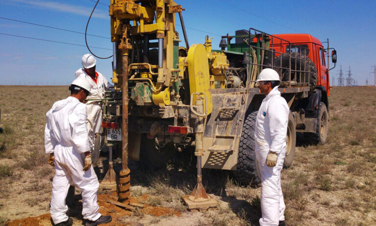
Topographic-geodetic and engineering-geological surveys, 500 MW WPP (Samarkand)
Engineering-geological survey of a power line (51 km), 500 MW solar plant (Sherabad)
Geotechnical studies, Nukus WPP (Karakalpakstan)
Cross-hole wave velocity measurements, 500 MW WPP (Bash, Zangeldy)
Engineering-geological surveys, 500 MW solar plant (Sherabad)
Engineering-geological surveys, combined power plant 1500–1700 MW (Uchkizil, Termez)
Geological exploration, «Dukhana» copper ore (Uzun district, Surkhandarya)
Engineering-geological surveys along a water-main route (65 km), Charvak — «New Tashkent»
Engineering-geological surveys (535 m drilling): Webster University and a school, «New Tashkent»
Engineering-geological surveys (635 m drilling): National Art Museum of Uzbekistan
Engineering-geological surveys (12 boreholes, 40 m each), «New Tashkent»
Thank you! Your request has been received
We will estimate the cost for your site and contact you shortly.