
Hydrogeology (groundwater analysis)
We study groundwater level, regime and chemistry, assess aggressiveness to concrete and steel, and the risk…
Hydrogeological surveys constitute an essential branch of geotechnical engineering investigations, dedicated to comprehensive exploration of groundwater aquifers, water table fluctuations, filtration dynamics, and subsurface chemical interactions.
Groundwater drives half of all foundation decisions: depth, waterproofing, and the need for drainage and dewatering. Hydrogeological investigation establishes water levels and their seasonal variation, chemical composition and aggressiveness to structures, and forecasts flooding of the area.
Across Tashkent and all developing regions of Uzbekistan, the accredited engineering center GEO PRO provides certified hydrogeological surveys Tashkent with full guarantees for state departmental expertise approval.
A timely and highly accurate groundwater analysis for construction empowers structural engineers to select the most cost-effective foundation systems, preventing severe flooding risks in basements and underground parking facilities.
Conducting a thorough groundwater level assessment Uzbekistan prevents uneven soil subsidence, concrete degradation, and loss of structural bearing capacity during seasonal high-water periods.
Why Hydrogeological Surveys are Essential for Construction Projects
In accordance with the Urban Planning Code and statutory building regulations of the Republic of Uzbekistan (KMK / ShNK standards), hydrogeological surveys are mandatory for:
- Designing deep foundations and multi-level underground parking for high-rise developments;
- Constructing industrial facilities, water treatment reservoirs, and critical subterranean utilities;
- Evaluating the hydrogeological impact of deep excavation pits on neighboring existing urban structures;
- Designing temporary construction dewatering and surface water interception systems during earthworks;
- Justifying long-term anti-seepage protection, drainage layers, and flood mitigation measures;
- Underpinning, reinforcing, and reconstructing existing building foundations affected by rising groundwater tables.
What We Do: Field Testing and Hydrogeological Exploration
The specialized hydrogeology department at GEO PRO conducts the complete spectrum of field measurements and in-situ hydraulic tests:
- measuring groundwater levels in boreholes and seasonal variation;
- water sampling and chemical composition analysis;
- assessing water aggressiveness to concrete and steel;
- pumping/filtration tests and flooding forecast;
- performing single-well and cluster pumping tests to determine aquifer hydraulic conductivity;
- calculating permeability, transmissivity, piezometric heads, and specific yield coefficients;
- installing dedicated piezometric monitoring wells for long-term hydrodynamic regime tracking.
Laboratory Assays and Water Aggressiveness to Concrete Testing
In our ISO-certified analytical laboratory, engineers conduct specialized water aggressiveness to concrete testing, evaluating corrosion risks for rebar reinforcement and protective coatings.
Chemical assays identify concentrations of sulfates, chlorides, bicarbonates, magnesium, calcium ions, free carbon dioxide, pH levels, and total dissolved solids (TDS).
Based on laboratory test protocols, structural designers select the required concrete impermeability grade (W), sulfate-resistant cement types, and appropriate primary/secondary waterproofing barriers.
Aquifer Hydrodynamic Modeling and Dewatering Calculations
Modern hydrogeological surveys require analytical and numerical modeling of subsurface water flow patterns.
GEO PRO engineers compute expected seepage flow rates into construction pits, calculate the radius of influence of depression cones, and size the required wellpoint dewatering installations.
This precise mathematical modeling prevents mechanical suffosion (piping) of fine sand particles from beneath adjacent operational buildings.
Deliverables: Flooding Forecast and Hydrogeological Report
A hydrogeological section of the report: water levels and regime, chemical analysis protocols, a statement on environmental aggressiveness, and recommendations for waterproofing, drainage and dewatering.
The client receives an officially approved technical package featuring a flooding forecast and hydrogeological report:
- Water-table contour maps (hydroisohypse and hydroisopiezic maps) showing groundwater flow vectors;
- Hydrogeological borehole logs with detailed lithological strata and screen interval specifications;
- Accredited laboratory analytical test certificates and geochemical water classification reports;
- Calculated maximum seasonal groundwater high-water marks projected across the facility design life;
- Engineering recommendations for optimal subsurface drainage layouts (blanket, perimeter, or ring drainage);
- Complete documentation set ready for successful submission to the State Expert Review Board.
Cost Factors and How to Order Hydrogeologist Services Tashkent
Pricing for site surveys depends on aquifer depth, the number of exploratory boreholes, the scope of pumping tests, and the density of chemical laboratory assays required.
Professional hydrogeological surveys eliminate structural moisture damage and optimize sub-structure construction budgets.
If your construction development requires accredited groundwater investigations, chemical assay verification, or certified hydrogeologist services Tashkent in Uzbekistan, contact the specialists at GEO PRO.
Need this service? Leave a request — we’ll estimate the cost for your site. Request an estimate or call: +998 97 744-55-11.
Why choose us
Licenses and permits
We work officially: a laboratory and permits for engineering surveys.
Modern equipment
Modern total stations, GNSS receivers and drilling rigs.
Experienced engineers
Surveyors, geologists and ecologists with specialized education and on-site experience.
Official report
A technical report accepted by expert review bodies and design organizations.
How we work
Request and brief
We clarify the task, site and objectives, and agree on the brief and cost.
Field work
We go on-site: measurements, survey, drilling and sampling to standards.
Processing
Office data processing, calculations and analysis in specialized software.
Report
We prepare and deliver an official technical report with results and recommendations.
Our work: geology
Projects completed by GEO PRO in this field — total 17.
Pile testing (Pile Drive & Pull-Out), Samarkand 2 Solar 500 MW
Drilling works (2000 m), Fergana region
Geotechnical surveys, LNG peak-shaving facility (Syrdarya, Tashkent, Turakurgan)
Steel pile test (DVT), photovoltaic plant (Kashkadarya)
Topographic-geodetic and engineering-geological surveys, Andijan PV plant 400 MW
Geotechnical and geophysical works, «Bash and Jankeldy» (Bukhara region)
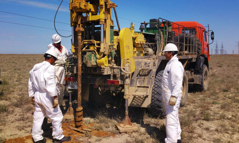
Topographic-geodetic and engineering-geological surveys, 500 MW WPP (Samarkand)
Engineering-geological survey of a power line (51 km), 500 MW solar plant (Sherabad)
Geotechnical studies, Nukus WPP (Karakalpakstan)
Cross-hole wave velocity measurements, 500 MW WPP (Bash, Zangeldy)
Engineering-geological surveys, 500 MW solar plant (Sherabad)
Engineering-geological surveys, combined power plant 1500–1700 MW (Uchkizil, Termez)
Geological exploration, «Dukhana» copper ore (Uzun district, Surkhandarya)
Engineering-geological surveys along a water-main route (65 km), Charvak — «New Tashkent»
Engineering-geological surveys (535 m drilling): Webster University and a school, «New Tashkent»
Engineering-geological surveys (635 m drilling): National Art Museum of Uzbekistan
Engineering-geological surveys (12 boreholes, 40 m each), «New Tashkent»
Thank you! Your request has been received
We will estimate the cost for your site and contact you shortly.