
Earthwork volume calculation: Cost control and engineering measurement precision
Zero-cycle earthworks consistently account for 15% to 30% of the entire capital construction budget. During excavation pit development, site grading for industrial plants, or linear utility corridor routing across Uzbekistan, a precise earthwork volume calculation represents a vital stage of geodetic quality assurance. Without independent instrumental verification, project developers routinely face substantial volume inflations billed by excavation contractors. GEO PRO delivers certified engineering and geodetic surveys alongside advanced computer-aided calculations, guaranteeing full financial transparency throughout earthmoving operations.
A rigorous earthwork volume calculation quantifies the exact volumes of cut, fill, soil displacement, compaction, and haul-off. Relying on rough visual approximations or primitive geometric formulas inevitably leads to bitter billing disputes, project delays, and unexpected budget blowouts.
Why do developers require independent earthwork volume calculations?
Amid intense urban and industrial growth in Tashkent and regional hubs, independent spatial auditing resolves several critical commercial challenges:
- Verification of contractor completion certificates: The physical volume of excavated foundation pits is reconciled against original design drawings and contractor invoices.
- Accounting for soil swell and compaction factors: In situ dense soil naturally expands upon excavation; incorporating accurate bulking coefficients prevents disputes over dump truck capacities and dispatch counts.
- Stockpile and bulk material inventory: Precise volumetric determination of gravel, sand, crushed stone, and spoil heaps stored on logistics yards and mining concessions.
- Mitigation of logistics overexpenditure: Mathematical precision eliminates billing for fictitious haulage runs and ghost machinery hours.
Field measurement technologies and surveying instrumentation
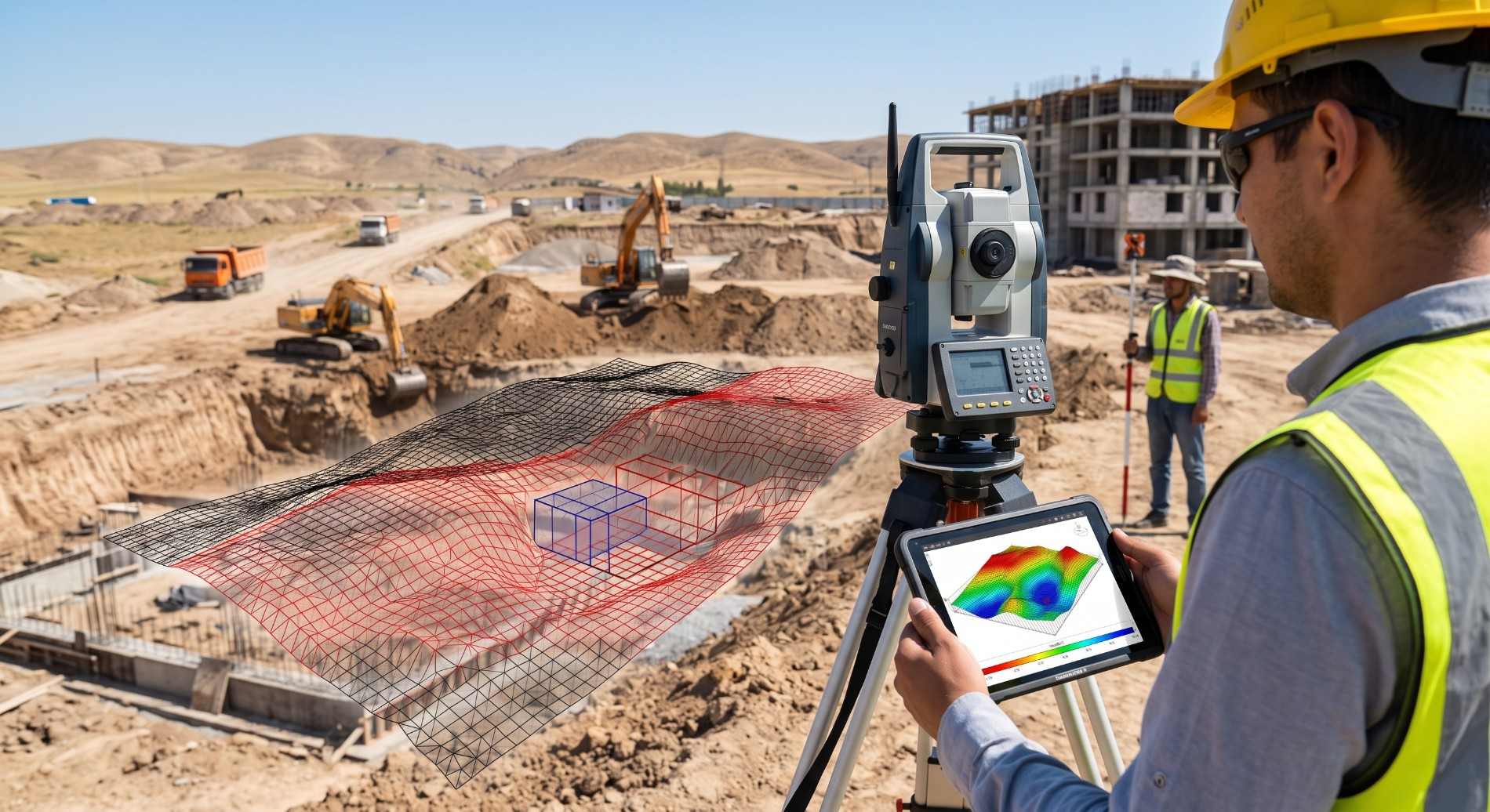
A professional earthwork volume calculation relies on capturing high-density 3D spatial models of the site both prior to excavation (natural terrain surface) and following the completion of each operational phase. The surveying teams at GEO PRO deploy industrial-grade hardware for maximum accuracy:
- Multi-frequency GNSS RTK receivers: Rapid determination of horizontal and vertical coordinates across open sites in real-time kinematic mode.
- High-precision Leica total stations: Millimeter-level measurement of foundation edges, deep pit bottoms, and steep slope breaklines where satellite signals are obstructed.
- Unmanned Aerial Vehicles (UAVs): Photogrammetric drone mapping for expansive sites, highways, and quarry dumps, capturing dense point clouds containing millions of spatial nodes.
Integrating these complementary tools captures terrain nuances without interrupting active earthmoving machinery on-site.
3D digital elevation models and earthwork cartograms
Acquired field coordinates are processed using civil engineering suites, including Autodesk AutoCAD Civil 3D and Credo. Our post-processing engineers build Triangulated Irregular Network (TIN) surfaces by superimposing the initial baseline terrain model onto the final as-built or design surface.
The definitive earthwork volume calculation is documented through a standardized earthwork cartogram. The site is partitioned into an engineering square grid (typically 5×5, 10×10, or 20×20 meters), displaying individual cut depths, fill heights, and respective soil quantities per cell. This balance sheet functions as an irrefutable engineering document for state technical supervisors and financial auditors.
Compliance with national building standards (SHNK and KMK)
All surveying procedures, calculation methodology, and as-built documentation strictly adhere to international earthworks engineering standards, as well as the urban planning codes of Uzbekistan: SHNK 1.02.07-15 (“Engineering surveys for construction”) and KMK 2.01.08-96 (“Geodetic works in construction”). Documentation prepared under these standards satisfies institutional audits and technical inspections without dispute.
Economic value and budget savings with GEO PRO
Field experience demonstrates that an independent earthwork volume calculation offsets the entire cost of geodetic auditing within the initial few hundred cubic meters of shifted soil. Catching an artificial overcount of just 5% to 10% saves project owners tens of thousands of dollars in unjustified excavation, trucking, and landfill disposal fees.
The engineering team at GEO PRO mobilizes swiftly across Tashkent and throughout the Republic of Uzbekistan. We provide our clients with granular volume reports, cut-and-fill balance sheets, and interactive 3D surface visualizations on tight timelines, delivering the mathematical clarity required to safeguard your construction investments.